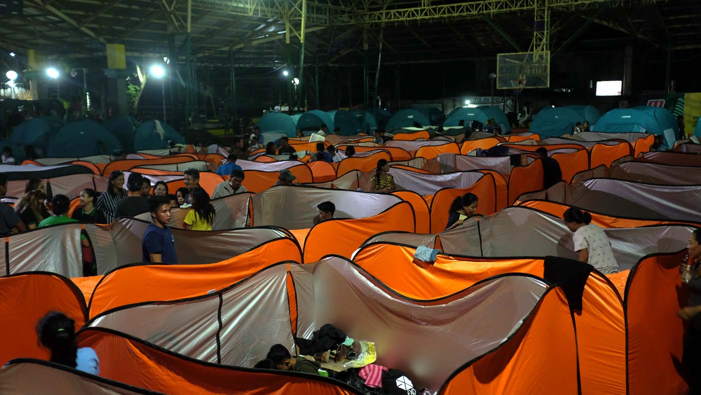
MANILA, Philippines– After thousands of Filipinos fled their homes due to the ongoing eruption of the Taal Volcano, questions on how to help evacuees flooded social media.
While inspiring, the surge of efforts to help the evacuees resulted in a conundrum: The absence of coordination led to a surplus of aid in some evacuation centers and a shortage in others. (READ: Batangas creates Taal Volcano donation hub, systemizes relief efforts)
Because of this, a number of Filipinos focused their attention on making sense of information and updates on social media to aid and guide relief efforts.
Calling themselves Taal Volcano eruption social media volunteers, this budding Facebook group is filled with posts from Filipinos coordinating help to those affected.
A quick scan of the posts on the Facebook group showed various people sending updates of what's needed in evacuation centers; and inquiries regarding rescue and donation drives that people can participate in.
Sarah Gildo Schürmann, the creator of the group, said she made the group all the way from Germany to build a "bridge between volunteers and people affected by the eruption."
Created a day after the eruption, it now has over 3,000 members. As of Thursday night, January 16, alone, there have been 468 new posts from Filipinos eager to coordinate relief operations.
In a matter of days, the Facebook group has built a community where citizens send updates on the situation on the ground and give tips on how and where they can help.
Mapping out needs
Aside from gathering volunteers in one platform, others maximized their skills to help those leading relief drives and giving donations.
Using her experience as a database manager of the Center for Disaster Preparedness, Sheena Opulencia created a basic Google map showing the locations of active evacuation centers. The map also includes a 14-kilometer radius illustrating the danger zones.
Using information from the Tanauan City Information Office, Batangas Public Information Office, and several Facebook posts, she made the list in hopes of making it easy for people to find evacuation centers that are in need of donations.
She was inspired to make the map after her parents got stuck in Tanauan City, Batangas, when the volcano erupted.
"I created the map based on how I will actually use it for my family and my fellow Batangueños who were affected by the eruption. Visualizing disaster data allows people to realign resources and identify areas that need more support than just looking at a list," Opulencia said.
Through the map she made, Opulencia hopes to help those leading relief drives know where they should go.
"Hopefully, the map will guide groups in bringing relief goods rather than going one by one to each barangay looking for the evacuation site, which can be time- and resource-consuming," she explained.
"Friends who are responding from Manila have been asking me where they can go, so now it's easy to refer them to these areas," she added.
Hoping to further help those providing relief, Opulencia is working on including the number of evacuees in the centers to her map.
Working together
Opulencia isn't alone in realizing the importance of mapping the evacuation centers. For instance, a group of Master of Science in Data Science students from the Asian Institute of Management (AIM) is working to make a web application showcasing a map of the affected areas. They will be using data gathered from online posts and government agencies.
"A lot of people are already doing relief goods and doing ops work, so we wanted to provide something to help them because it's really decentralized. People are doing their own initiatives separately. Our initiative could potentially be instrumental to them as a central platform for them to know or to decide where to send off their goods," Ria Flora, one of the students leading the team, said.
Partnering with Open Street Maps, the Humanitarian OpenStreetMap Team (HOT), and Rappler's disaster management platform Agos, this team of data science students hopes to maximize crowdsourced data for their web application named AIM Project DATOS (Data Towards Security). (READ: Call for Agos volunteers: Help gather Taal Volcano information)
They also have contacts in local government units to help get data on-site, while Agos volunteers monitor and verify online posts for the web application.
Aside from a map showcasing the affected areas, the web application will also pin down evacuation centers, along with the number of people and supplies sent to each one, for monitoring.
This will help people decide which evacuation centers need the most help.
Flora said they're hoping to launch the web application on Friday, January 17. Through this web application, the team hopes to highlight the need for a centralized platform for information to get everybody on the same page.
Why crowdsource?
Especially in the age of social media, Flora said that crowdsourcing information can get quick results.
"We are living in the time and age that data is everywhere," she said.
"We have to grow comfortable with crowdsourcing. We're not saying just take whatever Facebook posts as is. We're saying make use of this Facebook post as a starting point. We don't want redundancy in terms of efforts. The last thing we want is multiple initiatives doing the same thing," Flora added.
Crowdsourcing is at the heart of citizen initiatives like AIM Project DATOS and the Facebook group Taal Volcano social media volunteers. Flora highlighted the importance of access to information during disasters, especially information from government agencies, to give the public an idea of how they can help.
"We really just need access to information. With information, we can already extract so much. It's not just access, it's timely access to information. That's what makes it different," she said. – Rappler.com